Aerial Mapping
for Arizona
Photogrammetry, LiDAR, and high-precision drone mapping for surveyors and developers across the entire state of Arizona.
What We Deliver
Professional Aerial Services
Precision data collection and processing for engineering, planning, and development projects across Arizona.
Photogrammetry
High-resolution orthomosaic maps and 3D point clouds from overlapping aerial imagery. Ideal for topographic mapping, volume calculations, and site documentation.
- Orthomosaic maps (GeoTIFF)
- 3D point clouds (LAS/LAZ)
- Digital Surface Models
- Volume reports
LiDAR Mapping
Airborne LiDAR for accurate ground elevation modeling, vegetation analysis, and terrain characterization. Penetrates canopy cover for true ground returns.
- Classified point clouds
- Digital Terrain Models
- Contour generation
- Vegetation density maps
Data Processing
Raw flight data processed into analysis-ready deliverables using industry-standard photogrammetry and LiDAR software. Fast turnaround, multiple output formats.
- LP360 LiDAR processing
- Multiple CRS support
- CAD-ready exports (DXF, DWG)
- GIS-ready formats
Surveying Support
Coordinated aerial data collection for licensed surveying projects. We partner with Moon Valley Land Surveying for boundary and topographic surveys requiring Arizona professional licensure.
- GCP placement & targeting
- Aerial mapping accuracy
- Coordinate system matching
- Topo support for RLS partners
Construction Progress
Scheduled aerial documentation of construction sites to track progress, verify grading, and support project management from pre-construction through completion.
- Recurring site flyovers
- Progress comparison reports
- Cut/fill volume tracking
- Stakeholder-ready imagery
Site Inspections
Rapid aerial inspection of infrastructure, utilities, and large land areas. Safer and faster than traditional ground-based methods for remote or hazardous terrain.
- High-res inspection imagery
- Thermal imaging (on request)
- Annotated reports
- Video documentation
Power Line Inspection
Close-proximity drone inspection of transmission lines, towers, insulators, and electrical infrastructure across Arizona. Eliminates the need for costly helicopter inspections or dangerous manual climbs.
- High-res tower & line imagery
- Thermal anomaly detection
- Annotated defect reports
- Compliance documentation
Where We Fly
Arizona Statewide Coverage
Based in Goodyear, AZ — we deploy across the entire state. No project is too remote.

About Us
Locally Owned.
Precision Focused.
Aragon Drone Works is a locally owned Arizona drone mapping company dedicated to delivering accurate, professional aerial data to surveyors and developers who need results they can rely on.
We're fully licensed under FAA Part 107 and carry comprehensive liability insurance — so you and your clients are covered. Every flight is planned and executed with precision, and every dataset is quality-checked before delivery.
For projects requiring licensed survey services, we partner with Moon Valley Land Surveying, LLC — led by Jerry Dodd, RLS — providing coordinated boundary and topographic surveys under Arizona professional licensure.
Our Work
In the Field
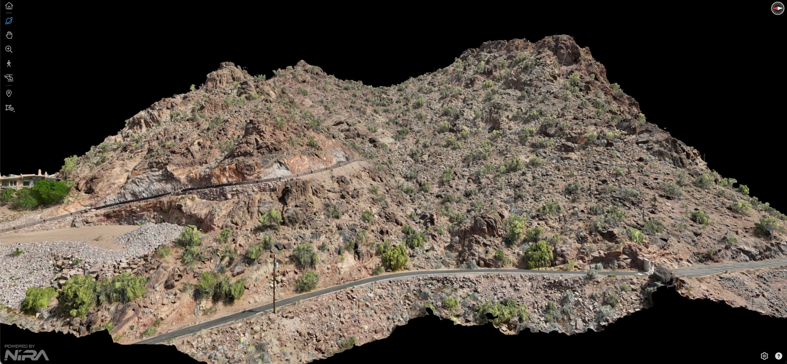
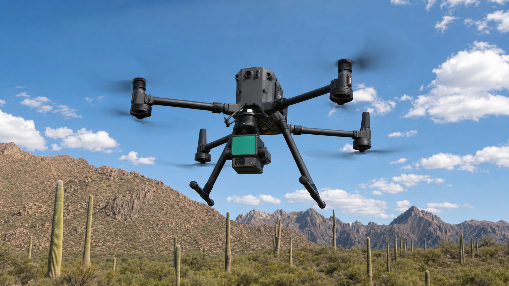
DJI Matrice 350 RTK with Zenmuse L2 LiDAR and Matrice 4E — our tools of choice for precision aerial mapping.
Matrice 350 RTK + Zenmuse L2 — desert terrain scan

Matrice 4E — construction site aerial mapping mission
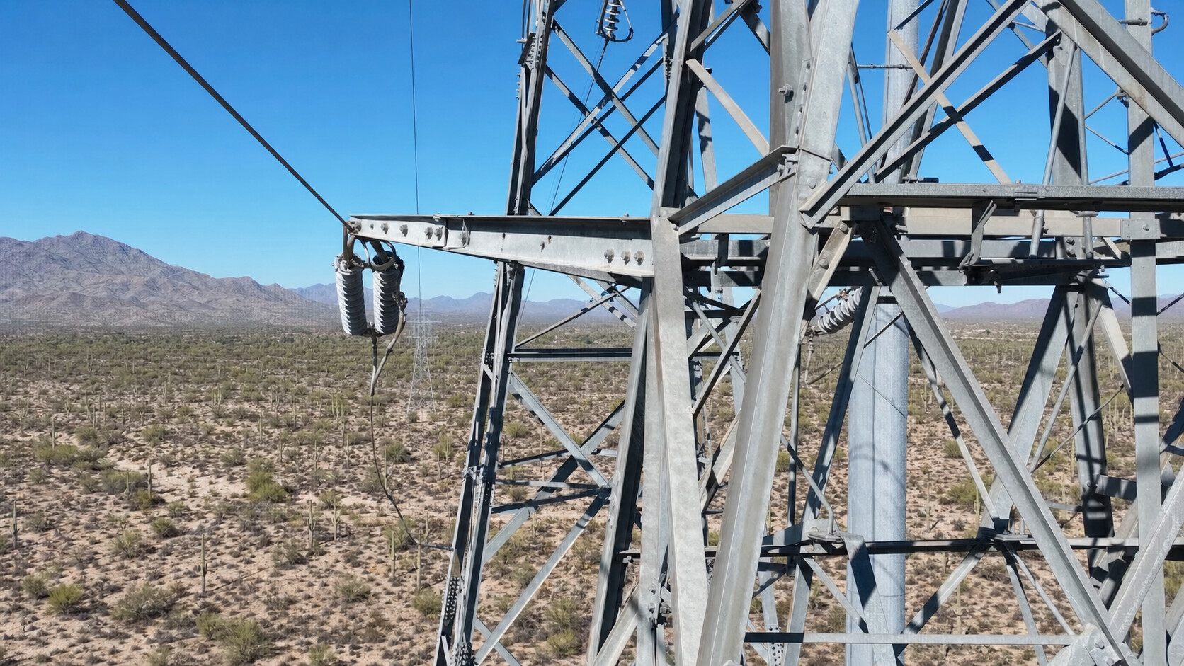
Matrice 350 RTK — transmission line inspection, Arizona
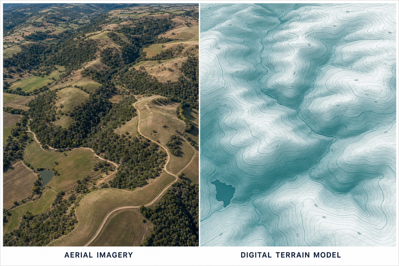
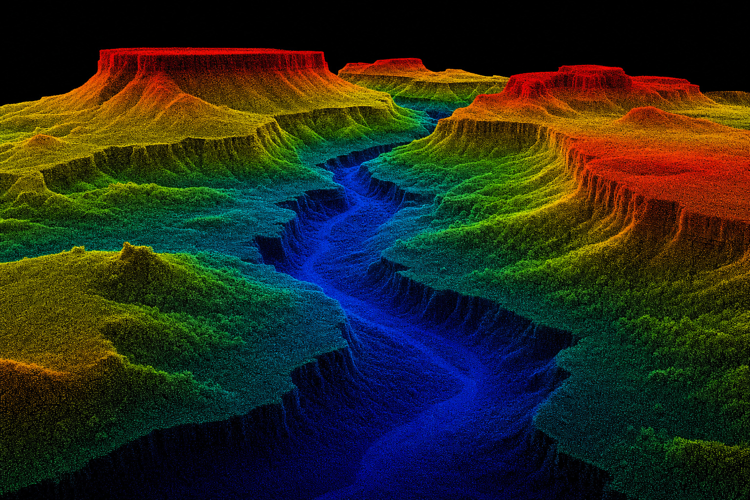
Aerial imagery vs DTM — terrain modeling deliverable
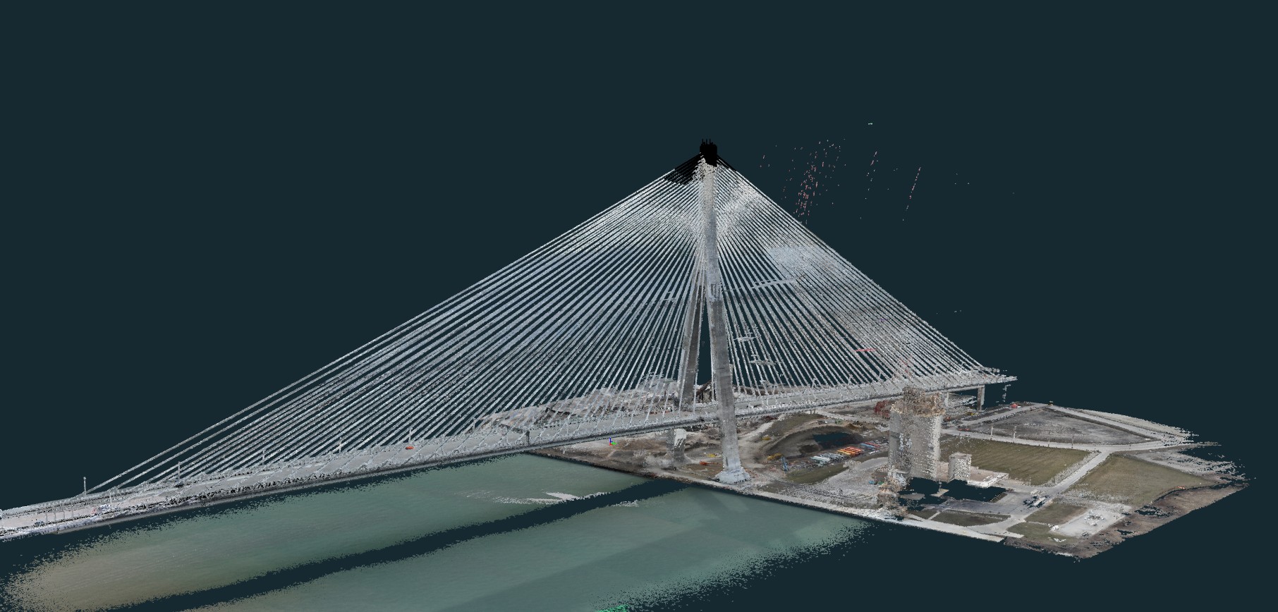
Gordie Howe International Bridge — true-color point cloud scan
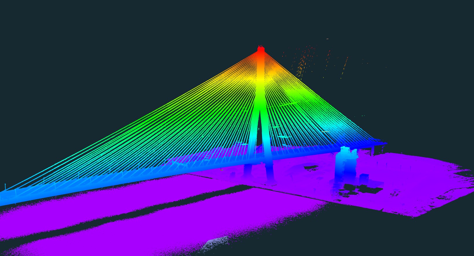
Gordie Howe International Bridge — elevation-classified point cloud
Have a project in mind? Let's talk about what we can deliver.
Call (623) 565-3210Common Questions
FAQ
What areas of Arizona do you serve?
We operate statewide — from Phoenix and the Metro Valley to Tucson, Flagstaff, Prescott, Yuma, Show Low, Kingman, and everywhere in between. No project is too remote.
Are you licensed and insured?
Yes. We hold an FAA Part 107 Remote Pilot Certificate and carry comprehensive liability insurance. We're happy to provide certificates of insurance for your project or client requirements.
What deliverable formats do you provide?
We deliver in the formats your workflow requires — GeoTIFF orthomosaics, LAS/LAZ point clouds, Digital Terrain Models, DXF/DWG for CAD, and standard GIS formats. Just let us know what you need.
Can you support licensed survey projects?
Yes. For projects requiring a licensed surveyor's stamp, we coordinate directly with Moon Valley Land Surveying, LLC (Jerry Dodd, RLS). This gives you a single point of contact for the full aerial + survey workflow.
What is your typical turnaround time?
Turnaround depends on project size and deliverable type. Most standard photogrammetry projects are delivered within 3–5 business days after flight completion. Rush delivery is available — ask us when you call.
How do I get a quote?
The fastest way is to call or text us at (623) 565-3210. You can also email us at jja@aragondroneworks.com. We'll discuss your project scope and get you a quote quickly.
Get in Touch
Ready to Start?
Call or text us to discuss your project. We respond quickly and can usually schedule within days, not weeks.